The borough council planning committee this morning is hearing a report on what is being called an "Active Travel Hub" but is more a large car park with a small bike shed, funded by an "active and clean" travel budget. The report contains several errors, including:
- The report title mentions an "Active Travel Hub" but the 55 cycle parking spaces are dwarfed by the 236 car parking spaces, which are new spaces and not relocated from any other location. Will this set a precedent allowing a new wave of large car parks in the area between the town walls and the bypasses, making the town transport strategy undeliverable?
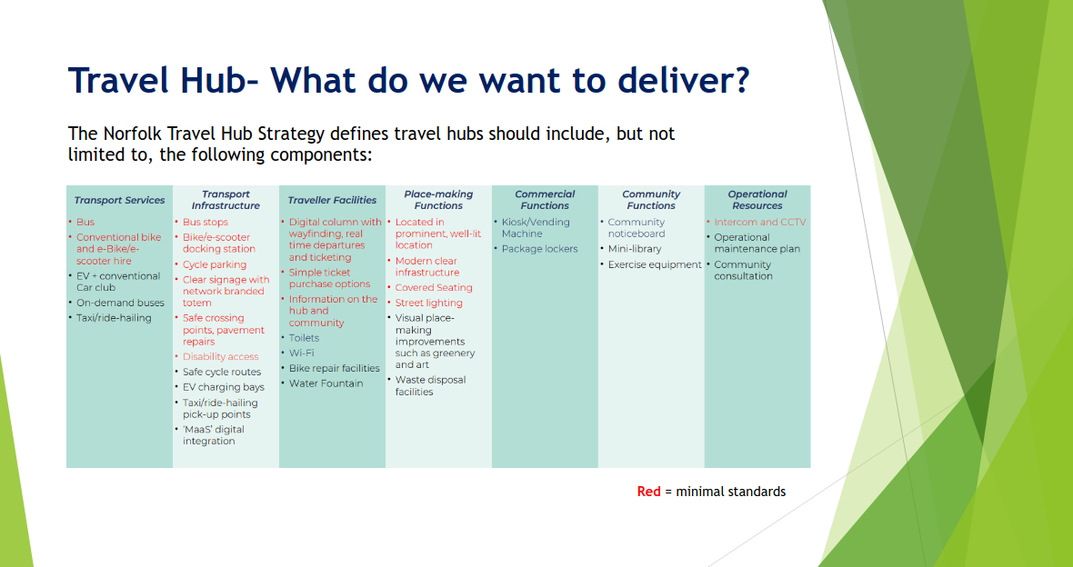
- The "Travel Hub" does not meet Norfolk County Council's definition of a travel hub, lacking components classed as essential including bike hire, safe crossing points, digital wayfinding, departure boards, ticket sales, community information and an intercom:
- On highway safety, page 16 of the report claims "The LHA has not raised any concerns in relation to these points" contradicting itself just two paragraphs earlier where it stated "The LHA has concluded that whilst a mini-roundabout or an alternative junction form would be preferable, it is unlikely that a formal objection could be sustained." There is a real safety concern here. The formal objection seems to be unsustainable only because the access road will be private, not adopted. There are still concerns!
- "The Applicant also confirms that direct and convenient connections have been provided to existing active travel routes (including the LCWIP Clenchwarton (Orange) route – approximately 1.3km from the site) connecting the site with the town centre" but no detail on the connection is provided, so it is not possible to assess if the link is safe and up to the standard of Department for Transport Local Transport Note 1/20 (LTN 1/20) Cycle Infrastructure Design, or compliant with the Active Travel England Standing Advice on planning applications.
- "Access will also be available to the local walking and cycling routes within the nearby park and residential areas" but while available, the report omits to mention that the access to those areas requires walkers and cyclists to cross roads used by all motorists entering or exiting the car park, connected by the unsafe and outdated crossroads layout.
- "The Applicant has advised that the design complies with relevant manufacturer specifications and provides appropriate clearances, circulation space and accessibility standards" but the report fails to mention that the design falls short of the Bicycle Association / Secured By Design / Sustrans Standards for Public Cycle Parking.
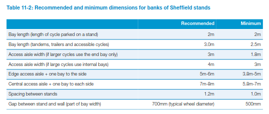
- The report incorrectly states "LTN/120 goes onto state that two-tier stands require a ceiling height of at least 2.7m but does not offer any further guidance in respect of floor space" when Table 11-2 clearly shows a 4m recommendation for an access aisle (when there are no staff to prevent large cycles being parked in some locations) and a 3m minimum, as shown here:
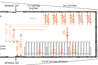
- "The Applicant has demonstrated that there is sufficient space to manoeuvre bikes on and off the upper-tier with cycles in place on the cycle hoops opposite" except that they haven't because the diagram submitted clearly shows even the substandard manufacturer clearance (the upper orange line) overlaps with a cycle parked in the hoops opposite, meaning that removing a bike from some positions on the two-tier rack would result in a collision, possibly squashing a person between two metal objects. The orange lines in this image are the manufacturer's minimum distance of 2.4m (still considerably smaller than the 4m recommended access aisle width in the above table), the back of a half-loaded bike at 2.1m from the rack, and the back of a bike completely on the rack at 1.635m. It is important to remember that most people will need to wheel their bike back almost straight until it is fully off the rack, which is why 4m is recommended in the DfT manual. The applicant seems unaware that bikes do not normally turn on the spot!
One improvement since the earlier version of this application was considered is that the limited-compatibility "streetpods" outside the bike shed have been replaced with Sheffield stands that can be used by a wider range of cycles. There has also been more detail given on how the hub is planned to operate, which is interesting, but isn't itself part of the planning permission decision. So I'll cover that in a future article.
The comment in reply to our objection that the location plan omitted some council-owned land seems strange ("Whether or not the Applicant retains ownership of other land on the wider NORA / KLEP site is not relevant in the determination of the application and does not mean that the Applicant is underrepresenting its holdings and by implication that it has less responsibility for cycle parking and other transport matters in this area. Such matters are not relevant in the determination of this application.") I agree it probably isn't relevant to the decision, but it seems surprising that the planning department is so willing to accept an inaccurate ownership plan.
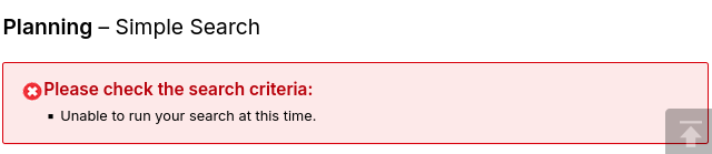
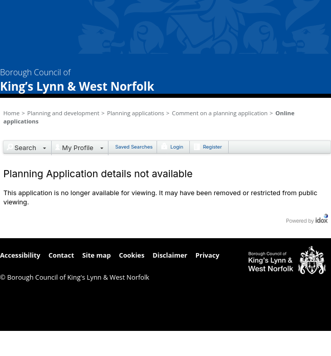
It is disappointing that KLWNBUG were not invited to speak or even notified this application we objected to is being brought before the committee again, unlike in the past, and we learned of it from a press article. Also, it seems unusual that a planning meeting is held on a last Monday rather than a first, but I expect the meeting date was published in lawful time. And finally, it's very difficult for volunteers to comment on planning applications in reasonable time when the council website so often shows error messages like this:
and this:
Thanks for reading to the end. There'll be more on this active travel car park project later...
Note: This article was edited to replace the blurry red-line image of the two-tier rack layout with a clearer one with orange lines from a different one of the 198 documents shown on the online planning site. The sheer size of this planning application and the lack of a useful index (or even clear summaries with 19 documents simply labelled "AGENT CORRESPONDENCE") has been another challenge for volunteers like us. Some have referred to it as a "snowstorm of paperwork".